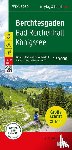
The Berchtesgaden XL hiking, cycling, and leisure map is the ideal map for hikes, bike tours, and excursions in the Berchtesgaden Alps. Thanks to its extra-large print, this XL hiking map is particularly easy to read. With this map, you can perfectly plan your tours and find information about sights and viewpoints along your route.
I have a question about the book:
‘Berchtesgaden - Bad Reichenhall - Konigssee - Freytag-Berndt’.
Fill in the form below.
We will respond as fast as possible.