Walking the Pennine Way Map Booklet

1:25,000 OS Route Mapping

Description

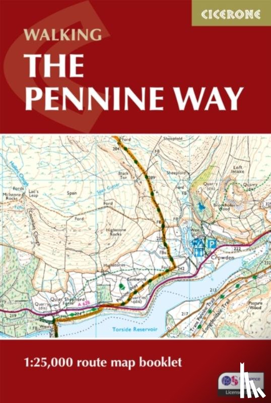
Map of the 265 mile (426km) Pennine Way National Trail, between Edale in the Peak District and Kirk Yetholm in the Scottish Borders. This booklet is included with the Cicerone guidebook to the trail, and shows the full route on OS 1:25,000 maps. This popular long-distance route typically takes three weeks to complete.
€ 21,55
Paperback / softback
 
Free shipping from
€ 19,95 within The Netherlands
Writer
Dillon, Paddy
Title
Walking the Pennine Way Map Booklet
Publisher
Cicerone Press
Year
2025
Language
English
Pages
136
Weight
156 gr
EAN
9781786311412
Dimensions
115 x 172 x 12 mm
Binding format
Paperback / softback

You will always receive the last edition from us!


Categories

Boekstra